Via Algarviana Stages: A Complete Guide to All 14 Sectors
A Complete Guide to All 14 Sectors of the GR13
Quick answer
The Via Algarviana (GR13) is a 308 km waymarked trail crossing the Algarve from Alcoutim to Cabo de São Vicente. It's divided into 14 sectors of 14 to 32 km, crossing the Serra do Caldeirão, the limestone barrocal, and the Serra de Monchique over 14 to 18 walking days.
Quick answer
The Via Algarviana (GR13) is a 308 km waymarked trail crossing the Algarve from Alcoutim to Cabo de São Vicente. It's divided into 14 sectors of 14 to 32 km, crossing the Serra do Caldeirão, the limestone barrocal, and the Serra de Monchique over 14 to 18 walking days.

The Via Algarviana (GR13) runs 308 km across the Algarve interior, from Alcoutim on the Guadiana River to Cabo de São Vicente on the Atlantic coast. The trail is divided into 14 official sectors, ranging from 14 km to 32.1 km, and crosses three distinct landscapes: the sandstone and schist mountains of the Serra do Caldeirão in the east, the limestone barrocal plateau in the centre, and the Serra de Monchique range in the west before the final descent to the coast.
Knowing the structure of the 14 sectors — their distances, terrain types, and service levels — is the starting point for planning any Via Algarviana programme. Some sectors are short and manageable; others exceed 30 km and almost always require transfer support or an overnight split. This article covers every sector in detail.
A broader overview of the Via Algarviana — covering difficulty assessment, seasonal guidance, accommodation, and transport logistics — will follow in a separate companion guide.
All 14 Sectors at a Glance🔗
Each of the 14 sectors is listed below with distance, official walking time, and terrain type. All distances and walking times are sourced from individual sector pages on viaalgarviana.org. The official walking times are approximate and vary considerably depending on fitness, pack weight, and conditions.
- Sector 1 → Alcoutim → Balurcos · 24.2 km · ~7h · Mountain / rural
- Sector 2 → Balurcos → Furnazinhas · 14.3 km · ~4h · Mountain / rural
- Sector 3 → Furnazinhas → Vaqueiros · 22.6 km · ~6h · Mountain / rural
- Sector 4 → Vaqueiros → Cachopo · 14.9 km · ~4h · Mountain / rural
- Sector 5 → Cachopo → Barranco do Velho · 29.5 km · ~8h · Deep Serra do Caldeirão
- Sector 6 → Barranco do Velho → Salir · 14.0 km · ~5h · Mountain / rural
- Sector 7 → Salir → Alte · 16.4 km · ~4.5–5h · Barrocal / rural
- Sector 8 → Alte → São Bartolomeu de Messines · 20.6 km · ~5h · Barrocal / rural
- Sector 9 → São Bartolomeu de Messines → Silves · 29.0 km · ~8h · Barrocal / hills
- Sector 10 → Silves → Monchique · 32.1 km · ~9.5–10.5h · Hills / mountain (long climb)
- Sector 11 → Monchique → Marmelete · 14.8 km · ~4–5h · Mountain
- Sector 12 → Marmelete → Bensafrim · 30.0 km · ~7h · Mountain / coastal transition
- Sector 13 → Bensafrim → Vila do Bispo · 29.7 km · ~7.5–8h · Coastal hinterland
- Sector 14 → Vila do Bispo → Cabo de São Vicente · 16.4 km · ~5h · Coastal
Note on Sector 10: Trail conditions on this sector can change. Always download the current GPX tracks from viaalgarviana.org before walking, and check the official sector page for any active diversions or alternative routes.
Eastern Sectors (1–5): Serra do Caldeirão🔗
The trail opens in Alcoutim, a quiet town on the Guadiana River with views across to Sanlúcar in Spain. The first five sectors climb steadily into the Serra do Caldeirão — one of Portugal’s most sparsely populated rural areas. The landscape is schist and sandstone, warm-coloured rock, holm oak, and cistus scrub. Villages such as Vaqueiros and Cachopo are authentic and quiet, with very limited services.
Sectors 1, 3, and 5 are the longest in this zone. Sector 1 (24.2 km, approximately 7 hours according to the official sector page) is a substantial opening stage and a reliable indication of the effort the full trail demands. Sectors 2 and 4 are shorter at 14.3 km and 14.9 km respectively, and provide natural recovery points within the longer sequence.
Sector 5, at 29.5 km and approximately 8 hours, is one of the longest on the trail and traverses the deepest interior of the Caldeirão. There are no facilities between Cachopo and Barranco do Velho. Walkers should carry extra water and food, and confirm dinner arrangements in advance — the main option in Barranco do Velho, A Tia Bia, is a combined accommodation and restaurant that takes reservations for dinner from the previous evening. A Tia Bia is confirmed open as of May 2026 (contact: rest.tiabia@gmail.com / +351 289 846 425 / atiabia.com).
The Serra do Caldeirão sections are the most remote on the entire trail. Mobile coverage is intermittent. Accommodation at overnight stops — particularly Vaqueiros and Barranco do Velho — is limited to one or two establishments each. Advance booking is not optional in this section.
Central Sectors (6–9): Barrocal, Salir to Silves🔗
From Barranco do Velho, the trail begins its transition from high mountain to the barrocal — the Algarve’s limestone platform between the mountains and the coast. The vegetation opens up, the path becomes less rocky, and the villages grow slightly larger and better served.
Sector 6 (14.0 km, around 5 hours on the official page) is shorter on paper but the gradient earns the time, arriving in Salir — a small market town with a Moorish castle ruin and reliable accommodation and dining. Sector 7 (16.4 km, around 4.5–5 hours) continues to Alte: whitewashed houses, the Fontes de Alte spring, and terraced gardens make it a natural rest point. Alte has multiple restaurants and works well as a mid-programme pause.
Sector 8 (20.6 km, around 5 hours) continues through São Bartolomeu de Messines, a larger town with good services and a wider choice of accommodation. The terrain stays predominantly barrocal, with rolling hills and well-maintained tracks.
Sector 9 (29.0 km, around 8 hours) is the longest in the central zone and arrives in Silves — the historic former Moorish capital of the Algarve. The official sector page rates this stage Difficulty V — Very Hard, reflecting the cumulative climb of around 1,370 m over the day. Silves itself is the best-serviced town on the central portion of the trail, with a well-preserved red sandstone castle, a lively centre, and a wide choice of places to stay and eat. Many self-guided programmes split Sector 9 with transfer support, either shortening the final approach to Silves or breaking the stage at an intermediate point.
Western Sectors (10–14): Serra de Monchique to the Atlantic🔗
Sector 10, from Silves to Monchique (32.1 km), is the longest on the trail and carries significant elevation gain as the route climbs into the Serra de Monchique. The official sector page puts walking time at around 9.5 to 10.5 hours — considerably longer than the terrain alone would suggest and a reflection of the sustained climbing involved. This sector almost always needs to be split in structured programmes, either with a transfer shortcut or an intermediate overnight stop. Trail conditions on Sector 10 can change; always download the current GPX tracks from viaalgarviana.org and check the official sector page for any active diversions before departure.
Monchique is the trail’s highest population centre — a mountain town known for its thermal springs at Caldas de Monchique and local medronho brandy. Multiple hotels and restaurants make it a natural rest point. Fóia, the highest peak in the Algarve at 902 metres, can be reached as a circular day walk (PR3 MCQ, 6.8 km) and is commonly used as a rest-day excursion from Monchique.
Sector 11 (14.8 km, around 4–5 hours) from Monchique to Marmelete is one of the shorter western stages — a welcome recovery day after Sector 10. The trail descends through woodland before arriving in the small village of Marmelete.
Sectors 12 and 13 are both long: Marmelete to Bensafrim (30.0 km, around 7 hours) and Bensafrim to Vila do Bispo (29.7 km, around 7.5–8 hours). These stages cross the coastal hinterland as the trail descends from the mountains toward the Atlantic. Services are limited across both stages. Like Sector 5 in the east, these long western stages often benefit from transfer support or intermediate stops in structured programmes.
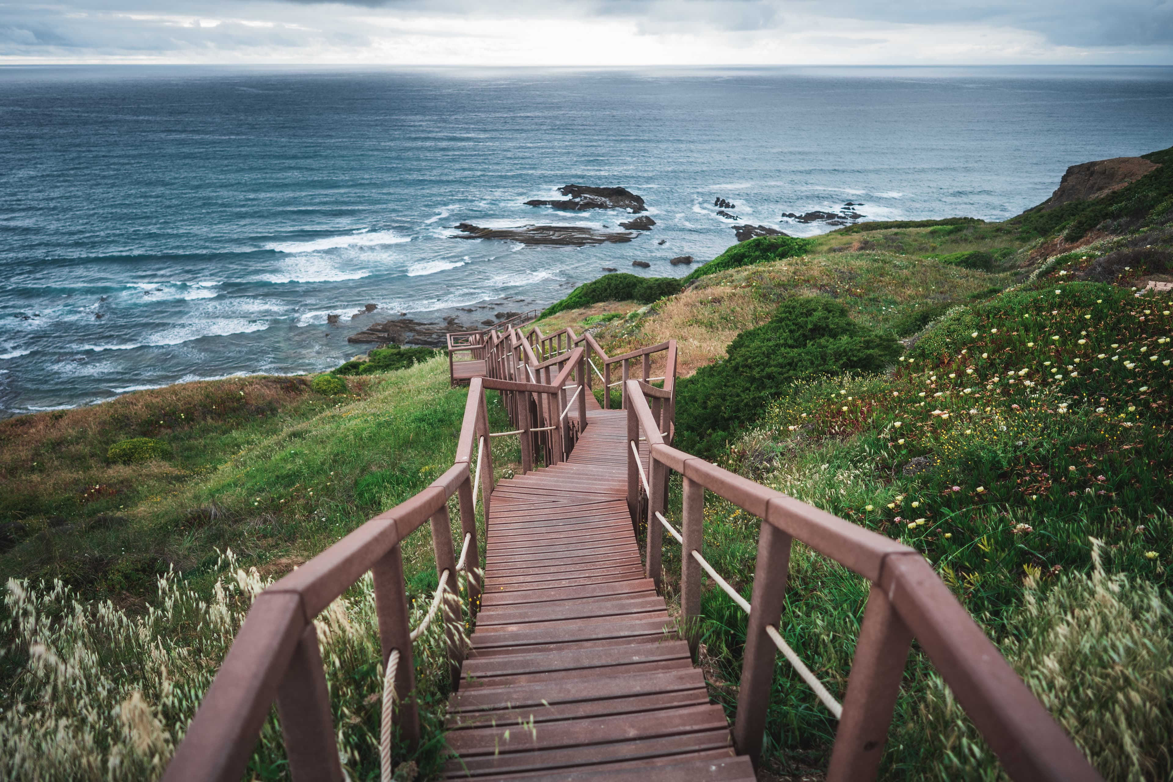
Sector 14 (16.4 km, around 5 hours) is the final stage, from Vila do Bispo to Cabo de São Vicente. Rated Difficulty II — Easy on the official page, it’s a comparatively gentle finish: the route crosses the windswept coastal plateau before arriving at the lighthouse at Cabo de São Vicente — the southwestern tip of continental Europe. This is also where the Via Algarviana meets the Rota Vicentina: walkers finishing the GR13 often continue onto the Fishermen’s Trail to walk northward along the Atlantic coast.
Which Sectors to Walk for Shorter Trips🔗
Walking all 14 sectors requires 14–18 days depending on pace and how long sectors are split. Several combinations work well as 5–8 day programmes — the eastern mountain sections (Sectors 1–7), the western mountain and coastal sections (Sectors 9–14), or a shorter focused section through one geographical zone. To discuss programme options, contact us at info@faroldiscover.pt.
Planning Tips for the Via Algarviana🔗
Which long sectors need splitting🔗
Five sectors exceed 25 km: Sectors 5 (29.5 km), 9 (29.0 km), 10 (32.1 km), 12 (30.0 km), and 13 (29.7 km). Sector 10 almost always needs to be split given its combination of distance and sustained elevation gain. Sectors 5, 12, and 13 can be walked in full by fit walkers, but require careful water and food management and should not be underestimated.
Water availability🔗
Water sources are reliable at overnight stops but absent on many long stages. The official Via Algarviana guidance recommends carrying a minimum 750 ml water capacity. On Sectors 5, 10, 12, and 13 — the four longest remote stages — carrying more than this minimum is strongly advisable. Check with your accommodation the evening before for current water source conditions along the next day’s route.
Accommodation planning🔗
Most overnight stops on the Via Algarviana have very limited accommodation. In the eastern sections, Vaqueiros and Barranco do Velho each typically have only one or two establishments suitable for walkers. In the western sections, Marmelete and Bensafrim are small villages with fewer options. The official Via Algarviana website advises booking all accommodation before departure. Booking several weeks in advance is advisable for spring (February–April) and sensible at all other times.
Farol Discover programmes confirm accommodation at all overnight stops before the programme begins, subject to availability.
Walking the Via Algarviana with Farol Discover🔗
Farol Discover is a licensed Portuguese DMC (RNAVT 10982 | RNAAT 148/2024), registered with Visit Algarve and Visit Alentejo. We operate self-guided and guided Via Algarviana programmes, including partial programmes covering selected sectors and full-trail formats. Our flagship route is the Via Algarviana self-guided journey, an 8-day programme through the untamed Algarve.
Our programmes handle the logistics that make the Via Algarviana demanding for independent walkers: advance accommodation booking in remote overnight towns, luggage transfers on interior roads, long-sector management with transfers or intermediate stops where needed, and emergency contact throughout.
We keep groups to a maximum of 12 participants. For walkers interested in combining the Via Algarviana with the Rota Vicentina’s Fishermen’s Trail, we manage the full logistics of both trails in a single programme.
To discuss a programme, contact us at info@faroldiscover.pt or visit faroldiscover.pt.
Frequently asked questions
The Via Algarviana (officially GR13) runs 308 km from Alcoutim, on the Guadiana River bordering Spain, to Cabo de São Vicente at the southwestern tip of continental Europe. The trail is divided into 14 numbered sectors ranging from 14 km to 32.1 km.
About the authors

Paulo Palhota
Owner, Tour Guide & Explorer
Founder and driving force behind Farol Discover. With a lifelong passion for connecting with people and cultures, Paulo finds joy in sharing the hidden gems of Portugal and beyond. Paulo's expertise in geography and languages make him not just a guide but a storyteller, enriching each journey with local insights.
Our programmes
Walk this with us

From the journal
Continue exploring

Via Algarviana
Discovering the Algarve Beyond the Beach: Slow Travel with Farol Discover
Slow travel, walking holidays, and local life in southern Portugal

Planning Your Walk
Guided vs. Self-Guided Hiking Tours: Which Adventure Suits You Best?
Discover the key differences between guided and self-guided hiking tours in Portugal to help you choose the perfect walking adventure for your travel style.

Seasons & Timing
Winter Wanderlust: Why Trekking in Portugal is a Perfect Winter Adventure
Discover the mild winters, stunning trails, and cultural richness that make Portugal the perfect destination for winter trekking enthusiasts.